The Planning Board tackled a packed agenda Monday night, reviewing some revisions to the new Charleswood School project and hearing a complex case for a subdivision off Benson Street that required a revision to a previous Planning Board decision made in 2006.
There was an overview of the plans for the proposed school, to be located at 147 Hayden Rowe Street, at the previous meeting. Principal Planner John Gelcich said the town is waiting to receive the peer reviews for the traffic plan, the engineering review and the stormwater management plan.
Chris Eberly, project manager for Vertex, the owner’s project manager, described an update to the plans for the 176,000-square-foot school for Grades 2-4. He said the team incorporated Planning Board and Conservation Commission meeting comments regarding parking and traffic flow.
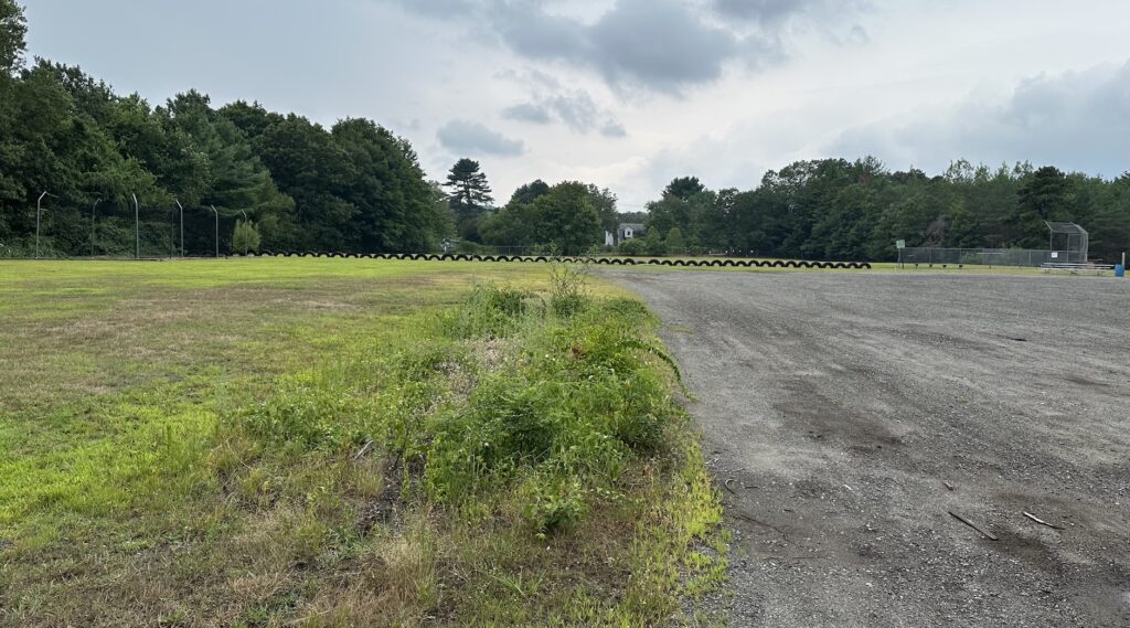
In response to the need for parking and the Conservation Commission’s desire to protect abutting wetlands, the athletic field was “shifted slightly to the north” to completely remove it from the buffer zone of the southern wetland. This shift moved the pervious parking spaces to be located on one side of the field and impervious parking spaces on the other side, each with “about 40 spaces,” according to architect Daniel Colli.
“We felt strongly that with the comments we heard here and from what we know about future and potential growth, a little bit more parking near the school was appropriate,” he added.
Chair Rob Benson said he was concerned when he heard that the windows would only cover about 25% of the school’s wall space. The team noted that the project was designed to capture as much available sunlight as possible. Wall space also is important because teachers use it in their instructional plans, added Superintendent Carol Cavanaugh.
The board scheduled a site walk for Saturday, Aug. 24. It also voted 7-0 to continue the hearing for the site plan review and the stormwater management permit until the Sept. 9 meeting and the decision deadline until Sept. 16.
Benson Road proposed subdivision raises issues
Property owner Wayne Comeau’s proposal revolved around a parcel he owns to the south of his home at 0 Benson Road. In a 2006-07 subdivision project approved by the Planning Board at that time, he had agreed to donate this parcel to the Hopkinton Area Land Trust (HALT) in exchange for an extension of a dead-end road.
Joe Marquedant, who spoke on behalf of the applicant, said Comeau was in the process of donating the land to HALT in 2016. At that time, he said Comeau received a letter from HALT president Dave Goldman that HALT “was no longer interested in the land.” The two parties agreed that Comeau could get the land back if he made a $1,000 donation to HALT.
Because the lot doesn’t have a conservation restriction, Marquedant said Comeau’s understanding is that “this lot is a buildable lot.” To build on that lot, part of the Planning Board’s 2006 decision regarding the land donation would need to be reversed.
Comeau explained that he didn’t convey the land to HALT over a decade because “time got away” and he forgot. He said Goldman told him the 1.6 acres of land was no longer of use to the organization because it was “in the middle of nowhere” and released him from the agreement upon the $1,000 payment.
Member Jane Moran asked why the Planning Board was never consulted and stressed that Comeau originally said he had no intention to develop that land.
Comeau replied that his attorney said he could go through HALT. He added that he now wants to build on that land for additional income.
While board members agreed that the intent of the 2006 Planning Board was for conservation, discussion between two attorneys dominated the hearing. Joe Antonellis represented an abutter, while Donna Wolf represented Comeau.
Antonellis said the donation of the land was a condition of the original agreement “for full conservation purposes” so that a dead-end street could be extended “under exceptional circumstances.” He questioned how the building permit for Comeau’s home could have been issued if all of the conditions had not been met after a decade.
He said the Comeaus are trying to “unjustly enrich themselves” by developing the parcel. As a land use lawyer, Antonellis said the Comeaus are bound by “a constructive trust” not to develop the land.
Wolf noted that Comeau has been paying property taxes on this land for years, and that “entitles him to use his land as he sees fit.” She said that the onus also was on HALT to pursue the situation over the 10-year period.
The board unanimously agreed to continue the hearing so that the previous documents could be reviewed.
The Trails proposes to remediate road damage
Peter Bemis, the engineer for The Trails, appeared before the board to present a plan to control the water flowing from the development onto Wilson Street. Now in its fourth phase of development, The Trails has been plagued by stormwater management issues for years that have negatively impacted Ashland’s water supply and prompted the Conservation Commission to assess fines.
Bemis and Vin Gately, the owner of The Trails, reiterated that they do not believe The Trails should be held totally responsible for all of the road damage. Bemis explained that a stretch of water flows from Legacy Farms North Road “without any drainage improvements for about 670 feet.” A stormwater basin exists at that point. He pointed out that this road has a country drainage system that he believes is insufficient.
Bemis showed an updated plan for the construction of a stone swale on the shoulder of the road that would extend about 785 feet, replacing the current gravel channel. Portions of the riprap channel would go down to 2 feet in the upper part and 3 feet in the lower part of the street to convey the water.
But because Wilson Street is “a very narrow road with country drainage,” installing this swale would take away the road’s shoulder, Bemis said.
Gelcich said that the plan had been reviewed by BETA Group, the town’s peer review consultant. BETA made comments and is awaiting a response from Bemis.
Gately told the board repeatedly that The Trails “should only be made responsible for our own flows” but not water flowing from upgradient land, as he said Kerry Reed, the Department of Public Works Director, believes.
Moran suggested that the original host community agreement be reviewed to see what it specified regarding drainage.
Gately noted that The Trails has been “a really good citizen to the town,” providing Hopkinton in 2023 with $3.5 million in tax revenue from its current 127 units. There will be 175 total units when this project phase is complete, units that he said require “very little town services.”
Benson said the parties involved need to come to a resolution, hopefully by the next meeting.
Added Benson: “We’re as anxious to get it off our agenda as you are to get it off your plate.”







0 Comments